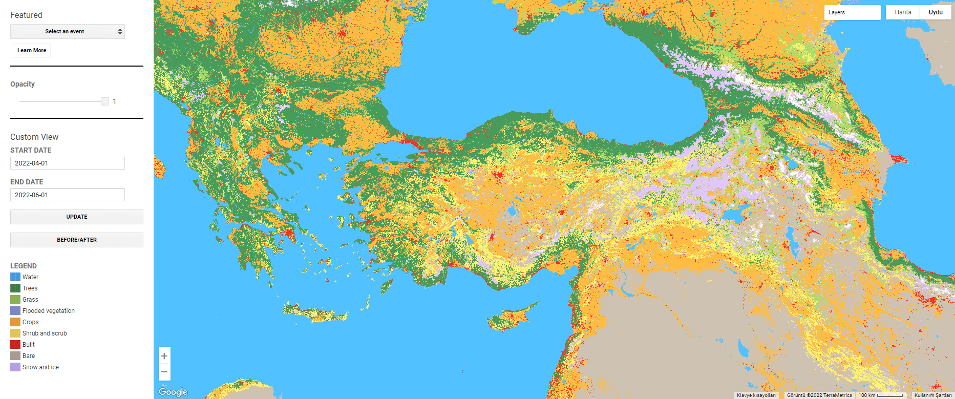
Google introduced Dynamic World, an online application that displays near real-time soil changes based on environmental events.
It is possible to see the land features instantly
This dataset, which is a kind of Google Earth overlay that allows you to observe the world in 3D from your mobile phone or computer, shows the features of the earth’s surface in almost real time. More concretely, it will be possible to instantly see the condition of the soil and the image of formations such as trees, crops or water on the map.

Usually, designing this type of map takes time and can take weeks or even months. Google relies on satellite imagery as well as artificial intelligence to produce a near real-time image, adding more than 5,000 images per day.
Purpose: to observe and predict trends related to climate change
As Google explains in an article published by the prestigious Nature magazine, these data are crucial for researchers and world leaders to quickly observe the effects of environmental events such as fires, floods or hurricanes, and to better respond to soil changes mainly caused by climate change.
Thus, we can conduct detailed research on the effects of global warming and climate change, and thus seek solutions for them.
You can open google dynamic world by clicking here.
First Image Source: unsplash
Read more here: nature


